Rantanplan : augmented reality to better understand and visualize social distancing
Date:
Changed on 03/07/2020

Within the Potioc project-team, which is a team focused on Human-Computer Interaction issues, we work notably around different concepts of Augmented Reality (AR) both in a purely exploratory and applied framework. With the coronavirus crisis, new terms have appeared in society, such as "social/physical distancing" or "barrier gestures". These terms, which we are not used to manipulating and implementing, were nonetheless absolutely vital to curbing the epidemic. In order for these gestures to be applicable by all, they had to be understood, especially by the youngest. With this in mind, we began to develop a first prototype PLAR application to interactively visualize what the terms barrier gestures and social/physical distancing meant.
We forwarded our proposal to the covid mission at the end of March. Following discussions with Philippe Gesnouin and Hugues Berry, we have developed the concept of PLAR into an application that helps Public Receiving Establishments (ERP) to reopen. The application would allow them to easily visualize the number of people that can be installed at a given location or how to easily move around a place while respecting distances and barrier gestures. This is how the RantanPlan project (for Réalité Augmentée pour NoTifier des AgencemeNts et aider à la PLANification) was born, leading to ARangement-covid, an AR application on smartphone and tablet that aims to assist in the implementation and display of signage elements (traffic direction, safety distances) within companies or places receiving the public (schools, shops, museums...).
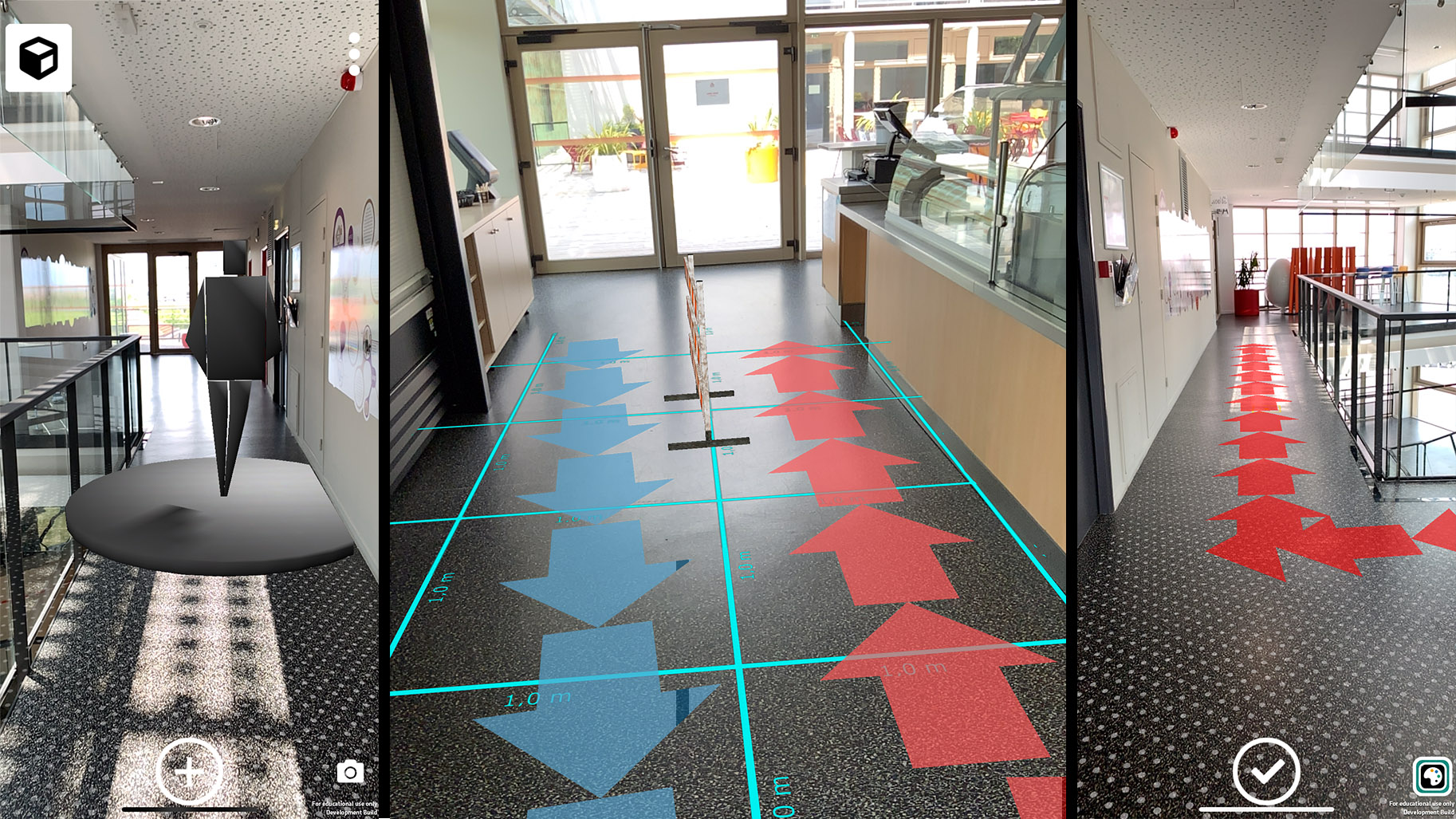
ARangement-covid makes it possible to simply apply a whole series of hygiene rules that the user can discover interactively and test directly within his establishment. This visualization makes these rules easily understandable and removes the few possible ambiguities in their interpretation. Thanks to the use of ARangement-covid, the ARangement-covid user can, with his smartphone, scan one or more rooms of his establishment in order to create a virtual representation of the physical space. He can then easily add virtual elements by pointing directly to the concerned area to instantiate different virtual objects (disks with a diameter of 2m, paths, arrows, barriers, 3D characters...). He then chooses the points of view that interest him and can take pictures of the increased space in order to print them and arrange them in different places of the concerned place. In addition, some features can help him in the realization of his layout, such as the display of a grid of 1 m by 1 m at ground level.
After the first experiments, either alone or with two engineers from the Potioc project team, we got the GO for the covid mission. In total, a team of 8 people worked for 6 weeks to develop the concept and do the first user tests. A first version will soon be available on the App Store and the Play Store. We are also looking for partners to develop the RantanPlan concept, both in terms of research and support, to see beyond this sprint of a few weeks.